17.5.11

La Tasmanie sous la pluie et le brouillard

Russell Falls

Afin de bien découvrir la Tasmanie, je me suis inscrite pour une tournée de 6 jours. Ce coup-ci, nous étions 11 participants, dont trois Français qui avaient commencé par le nord et étaient donc à mi-trajet. Le reste du groupe était formé de deux Suisses Allemands, un Suisse francophone, deux Allemandes, une dame de Singapour, une Philippine de Melbourne, et moi-même, ainsi que notre guide natif de la Tasmanie.
Nous avons fait beaucoup de route notre première journée. Hélas, le temps frisquet et pluvieux qui sévissait à Hobart nous a suivi dans les montagnes. Nos fenêtres étaient bien embuées et même en s’arrêtant pour une prise de vue sur ce qui est sûrement très scénique, c’était le brouillard.
Nous avons quand même fait plusieurs arrêts et quelques petites promenades, question de quand même nous imprégner de toute cette verdure. Dans cette région qui surnommée « The land of Giants », on retrouve autour du mont Field les eucalyptus qui sont les plus grands feuillus du monde. Hélas, avec le déboisement pour les terres agraires et les pâtes et papiers ces géants sont de plus en plus rares.
On s’est arrêté à de nombreuses chutes pendant notre tournée, en commençant par Russell Falls. C’est en 1885 qu’on créa la première réserve autour de Russell Falls. La réserve fut agrandie avec la création du parc national Mont Field en 1916 qui, avec Freycinet sur la côte est le parc national le plus vieux de l’état.
Youpi de la neige!
Pour dîner, on s’est arrêté au lac St Clair où il avait neigé quelques jours auparavant. Comme c’était ma première neige en plus d’un an, j’en ai profité pour faire quelques boules de neige.
Après dîner, on s’est arrêté à la rivière Franklin, lieu de manifestations très importantes dans les années 80. Hydro-Tasmania voulait y bâtir un autre barrage électrique. Finalement, c’est le peuple qui a gagné et le barrage n’a pas été construit. De plus, la rivière est devenue un site patrimonial.
La rivière Franklin

On a aussi fait un petit saut pour voir les chutes Nelson. Avec toute cette pluie, les cours d’eau étaient magnifiques.
Les chutes Nelson

Avant d’arriver à notre auberge pour la nuit, on s’est arrêté dans une petite ville presque fantôme : Queenstown. Autrefois une ville prospère grâce à l’industrie minière, elle dépend maintenant surtout du tourisme, car les mines ont optimisé leurs méthodes d’extraction qui nécessite moins de main d’œuvre.
Notre auberge était à Strahan. Elle est l’ancienne maison d’un des propriétaires miniers de la région et appartient à la compagnie de tour. Après souper, on a relaxé et joué plusieurs parties de uno. J’avais aussi fait le plein de tisane sentant un rhume à l’horizon. J’avais raison, je me suis réveillée le lendemain avec une extinction de voix qui allait durer quelques jours.

Notre guide, surnommé Wombat, était aussi enrhumé et semblait un peu maussade. Il était cependant une source fascinante d’information sur la région. Tout au long du trajet il avait des anecdotes de toute sorte. Hélas, les Allemandes avaient la fâcheuse habitude de rigoler pendant ses histoires. Je devine que c’est plus dur de suivre quand l’anglais n’est pas ta langue maternelle, mais bon. Notre première nuit étant à Strahan, notre guide nous a parlé de l’ancien site pénal de Maquarie Harbour situé tout près et des tentatives d’échappement dont celles d’Alexander Pearce adepte de cannibalisme. Cette histoire a été reprise à l’écran dans Van Diemen's Land.

Ocean Beach
Le lendemain matin, après avoir exploré Strahan qui est désormais une petite ville touristique, on s’est dirigé vers Ocean Beach. Comme il n’y a aucune terre entre l’Amérique du Sud et cette côte, le temps était très venteux et frisquet.
On a ensuite fait une promenade d’environ trois heures aux chutes Montezuma. Le soleil et la pluie alternaient et bien que les chutes étaient loin, ça en valait la peine. Le torrent était tellement puissant que je n’ai pas pu prendre de photo rapprochée, car c’était comme être sous une douche. Je me suis donc contentée de la vue à partir du pont suspendu.
En se dirigeant vers les chutes


Les chutes Montezuma vues du pont suspendu

Proche des chutes, on a aussi pu jeter un coup d’œil à un des tunnels miniers qui peuple les collines dans le coin. On y extrayait du fer, de l’or, de l’argent, du plomb et du zinc et le tout était transporté par la petite voie ferrée qui est devenue le sentier.
Un vieux tunnel minier
Après s’être arrêtés pour dîner à Zeehan, une autre ville déserte, on a poursuivi jusqu’au parc national de Cradle Mountain où on allait dormir ce soir-là. À la tombée du jour, on est aussi allé à la recherche d’animaux nocturnes, mais ils étaient plutôt timides. 

15.5.11

Hobart

I had promised myself that I would make my way to every Australian state. The only one left was Tasmania. To get the most out of it, I booked another group tour that would take me throughout the state in six days. But before I left on this adventure, I wanted to catch up with the swing dancing friends from Hobart I’d made throughout previous dance events on the mainland, so I made sure I landed in time for their Wednesday weekly social at the Queen’s Head.
They had a live band, which was quite upbeat. I danced a bit and met Liv, who would be my host during my stay in Hobart.

The next day, I took the bus in from Liv’s to the city as she lives in Blackman’s Bay and took in the sites. As I only had seen the city in the dark, I was quite delighted to discover a scenic town where the homes cling on to the mountainside. I have the impression that everyone has a great view from their home.
After a stop at the tourism information centre for some inspiration, I visited the Tasmanian museum and art gallery. I mostly enjoyed the videos portraying Aboriginal women doing their art, may it be pearl necklaces or basket weaving. I also enjoyed the exhibit on Antarctica. One could press buttons to hear different kind of whales, and what do you know, Dory in Finding Nemo wasn’t kidding when she says she speaks whale.
The neighbourhood of Battery Point
Afterwards, I walked along the small harbour up to Salamanca Place that turns into a market place on Saturdays. The buildings are former warehouses for the port of Hobart and are now filled with shops and restaurants. In that sense, it’s a bit like the old port in Montreal, but the buildings here are less ornate.
I also went to check out Battery Square and read about the cannons that were never used for defence but only for official ceremonies before eventually being removed. The Battery Point neighbourhood has some lovely homes. There are even some houses dating from the original European settlement such as those found at Arthur Circus. The original land owner had some high hopes for the land as the park sign says : Part of an original grant to the Reverend Robert Knopwood, this site was purchased by Governor Sir George Arthur in 1829. When he resold the land almost 20 years later, the auction advertisement described “delectable building sites in a neighbourhood that will inevitably become The Resort of the Beau Monde”.
One of the Arthur Circus Homes
I wandered some more until nightfall, found some dinner, and met up with Liv and headed with her to the committee meeting for the upcoming Devil City Swings event at Kara’s place. It does seem like it will be a great event.
Having now visited two Hobart homes, I had now realised that even though it gets quite chilly, (I could see the snow on the nearby mountain tops, and was wearing my tuque, gloves and scarf!), they mostly heat one main room in the house where everyone gathers such as the living room or kitchen. I’m guessing this is due to lack of proper house insulation and a high cost of energy. It does make me thankful for our warm insulated Canadian homes!

MONA
A Rainbow on the way to the MONA
On Friday, I went to visit the MONA, the Museum of New and Old Art. Opened in January, it’s the largest privately funded museum in Australia. Most of the artwork belongs to millionaire David Walsh and apparently the current exhibit features about ¼ of his collection. To get there, I took the MONA ferry from Hobart. The half hour ride was quite pleasant as I enjoyed a coffee and Danish while watching the scenery.
Getting off the MONA ferry
To visit the MONA they give you a modified ipod that lists nearby art according to your location. You then click for more information, collectors’ ramblings or audio clips. You can also vote for the ones you like and retrieve your visit online afterwards.
The MONA collection is definitely one that makes one react. Images of death and mutilation, a room filled with screens of Madonna fans singing her songs more or less in harmony, liquid words, pulse lights, bags of digesting bacteria, and so many more cannot leave you indifferent whether you like the art pieces or not.
My favourites were the pulse room by Rafael Lozano-Hammer where you held these two sticks that read your pulse and then mimicked it in the light bulb above. As more people do it, your pulse moves along to the next light bulb and so forth for 108 light bulbs.
Monkey skeleton
I also enjoyed the Mummy and coffin of Pausiris, especially its setting. To get to it, you have to walk on stones surrounded by water. Having seen a similar scene in too many movies and video games, I did think that the stones might vanish as I stepped on them to reach my goal. But they were firmly fixed and the water was only a foot deep. Beside the coffin, there was a video rendering of the scan of the mummy and its bones. Other favourites for me were a multilingual version of the Jungle Book where each character spoke a different language as well as a monkey skeleton sitting on a chair. After my tour, I still had a couple of hours before my ferry back to town so I hung out in the lobby area with my book looking up every now and then to enjoy the scenery on the other side of the large windows.
On Saturday, Liv & I headed to the Salamanca market. Unfortunately, I have no pictures but it was a lovely autumn sunny day and there were many pretty artsy things on display. We went to grab lunch at this laundry mat/café and Liv ran into a few friends. Clearly, Hobart is a small town, especially when you’re in the Arts school circuit. After a great day of chilling I bade farewell to my lovely host and her mother and spent the night in a hostel in town as I had to set out at 6 am for my Tour of Tassie.
Liv works in the building on the right. In the 1920s, this set of buildings
was the H.Jones Jam factory.

10.5.11

Les Grampians et le Great Ocean Road

Un rappel pour les touristes qui
louent une voiture

Lors de mon dernier message, je repassais à Adélaïde, le temps d’une journée avant d’entamer un nouveau tour guidé de trois jours qui me mènerait à Melbourne via les monts Grampians et le Great Ocean Road. Cette fois-ci, nous étions un groupe de 11, formé des 4 Britanniques, 2 Allemands, 1 Suisse, 1 Suisse-Allemande, 1 Écossaise, 1 Polonaise ainsi que votre Canadienne de fonction.

Oui oui des kangourous blancs
Notre première journée fut surtout consacrée à faire du kilométrage pour se rendre à Halls Gap, au creux des monts Grampians. En chemin, on s’est arrêté à Bordertown, tout près de la frontière entre South Australia et Victoria pour y voir des kangourous blancs. Ceux-ci sont les descendants d’un premier kangourou albinos capturé il y a 30 ans. Compte tenu de leur pelage, ils ne feraient pas long feu dans la nature ne pouvant point se camoufler dans le paysage, c’est pourquoi ils sont dans cette réserve.

Hollow Mountain
En après-midi, nous avons monté Hollow Mountain qui était assez vertigineuse avec une belle vue malgré le temps nuageux. Hélas, un incendie a détruit la moitié du parc des Grampians en 2006, mais elle semble bien se débrouiller en reboisement.

Après notre nuit à Hall’s Gap, nous avons grimpé tout près jusqu’au Chatauqua Peak. Bien que le parcours montait toujours, c’était de la petite bière comparée aux excursions de la veille et dans les Flinders. Comme la région a été bien touchée par les inondations de cette année, le choix des promenades était limité. La vue était quand même intéressante, et très verdoyante.
Au bas de la piste à Hall's Gap

Du haut de Chatauqua Peak

Great Ocean Road

Après notre promenade matinale, nous avons mis le cap pour le Great Ocean Road. Construite après la 1re guerre mondiale par environ 3000 soldats qui ont eu la chance de revenir au pays, elle est un hommage à leurs confrères défunts. Mesurant 243 km, elle propose un parcours sinueux le long de la côte avec de nombreux arrêts pour les touristes comme nous. Bien que le matin avait été ensoleillé, ce sont les nuages et la pluie qui nous attendaient sur la côte, alors certains de nos arrêts étaient plutôt brefs.

Voici le London Bridge, et dans ce cas-ci, il a bien tombé, comme dans la chanson London Bridge is Falling Down. Il y avait autrefois deux arches et à une époque, les gens y conduisaient même leur voiture pour aller piqueniquer au bout. Tiens tiens, wikipedia l’appelle maintenant le London Arch (et il semblerait que le Rocher Percé avait aussi deux arches jusqu’en 1845, merci wiki). Le 15 janvier 1990, le bout manquant s’est affaissé. Une famille venait de quitter l’espace et fut donc saine et sauve tandis qu’un couple était toujours sur l’arche restante. Selon notre guide, le couple a tenté de se cacher des caméras médiatiques pendant leur sauvetage par hélicoptère, car ils étaient en train de tromper leurs conjoints respectifs et ne voulait pas que ça se sache.
London Bridge devenu London Arch

Voici le Razor Back, un autre beau témoin de l’érosion.
Razor Back

Et voici un creux près de Loch Ard Gorge sur la Ship wreck coast (Côte des naufrages). À l’époque, les bateaux au large faisaient la fête la veille de leur arrivée à Melbourne et, régulièrement, quelqu’un se trompait et se retrouvait à s’enligner trop tôt vers la côte pour y faire naufrage. Dans le cas du Loch Ard, un navire anglais qui vit sa fin en 1878, il y a eu seulement deux survivants qui trouvèrent refuge dans la Gorge. Évidemment, s’ils avaient tenté de nager de ce côté-ci, seulement quelques mètres plus loin, ils n’auraient point survécu.

Il était maintenant temps de voir ces colonnes érodées qui sont le *must* de la Great Ocean Road; les 12 apostles (12 apôtres). Le soleil était surtout derrière les nuages, faisant pour des photos pas trop dignes d’une carte postale, mais les nuages rendaient ça quand même intéressant. Un des 12 apôtres s’est écroulé il y a quelques années, et pour le chiffre 12, les pancartes nous disent que certaines colonnes sont cachées. Au siècle dernier, on les appelait Sow & Piglets (la truie et ses porcelets), la truie étant Mutton Island et les colonnes, les porcelets. Visiblement quelqu’un a décidé que des apôtres seraient plus vendeurs. Qu’importe, c’est quand même magnifique, et je suis bien heureuse d’y avoir été, car qui sait combien de temps ce paysage va durer avec l’océan du sud qui ne cesse de déferler ses vagues sur la côte.
The 12 apostles

Le lendemain matin, on a fait le tour d’une parcelle de forêt tropicale qui avait une installation en hauteur pour se promener parmi les arbres. Et là je me demande pourquoi on dit rainforest en anglais et forêt tropicale en français, car dans ce cas-ci, on n’était vraiment pas dans les tropiques, mais pour la pluie, ça oui, il y en avait tout plein. En fait, je me corrige, le GDT me dit que c’est forêt ombrophile. Mais bon, j’ai vraiment tripé sur la verdure de la mousse sur les arbres que voici.


Pour dîner, on s’est arrêté à Apollo Bay. Désormais, on n’était plus sur la côte des naufrages, mais celle du surf. C’est dans ce coin qu’on débuté les marques Rip Curl et Quick Silver. On a d’ailleurs fait un arrêt à Torquay pour ceux qui voulaient faire les boutiques de marques surf. Ce n’était pas mon genre, mais certains ont semblé apprécier. On est arrivé à Melbourne à l’heure de pointe et je me suis dirigée chez Claudine & Simon, des amis québécois expatriés le temps de me reposer pour ensuite repartir vers la Tasmanie cette fois-ci.

Tu sais que tu es proche de la côte lorsque...

Apollo Bay

Qui dit océan dit mouettes


6.5.11

Around Quorn


A runway on the highway

We spent the last two days of our trip in and around the village of Quorn where we stayed in dorms set up beside this old mill. But before we got there, we did have a long day of driving from Coober Pedy.
We did stop a couple of times along the way. Our guide pointed out the runway on the highway used for emergency trips by the Flying Doctors organisation. Local police then come and block the highway off for the landing, and departure.
We also went to another salt lake, just off the Ghan tracks. It actually had a bit of water in it with the rain and all that. We had fun taking pictures there.
The Ghan track

The Salt Lake seen through a rusty hole

The tip of the old jetty
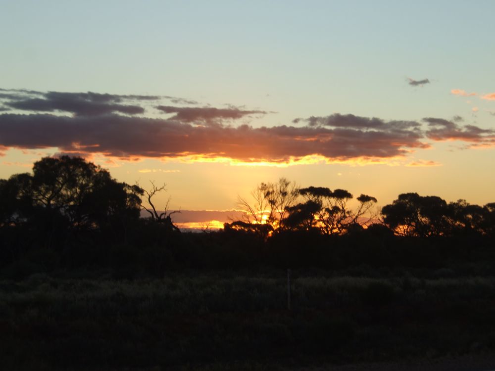
Sunset from the highway

We had an early first night in Quorn and had to be awake and in shape for the next day’s hike. Once again, we had a mouse in our room. I guess it was nice and comfy. It stayed away from my wrapped food but did decide to taste Rachelle’s apples.

The walk was up to Mount Ohlssen Bagge at 923 metres. It’s located in the Wilpena part of the Flinders Ranges National Park. The 6.4 km return trip was a bit steep but quite manageable when one stops often for water, snacks and picture taking! And as it was overcast, not too much sweating either. Speaking of the weather, it’s quite a bit cooler down in these parts and it definitely dropped below zero during the night. So I think my shorts will be taking a small break in my last weeks in Australia.


On top of Mount Ohlssen Bagge


After our walk, we had lunch with the kangaroos. Clearly, someone hasn’t been reading the – do not feed the animals – sign and they become quite aggressive when trying to have your food. But my heart still went ooh and ahh for the mother and her joey. Actually, we saw some more aggressive kangaroos in our way in and out of the park, they were fist fighting! It was quite entertaining to watch, though there was no clear winner.
Photo par Gosia


The sun came out in the afternoon and we stopped briefly at the Kanyaka Homestead ruins built when no one really wanted to come and venture life near the Flinders. The light and empty window frames were a delight to photograph!


We then headed for a camel ride. It wasn’t really included on our tour, but we had time, and $25 for a half hour ride sounded just right. Here’s a brief camel history taken off the wall of another camel placed we stopped at on our first day. “ The first camel in Australia was imported from the Canary Islands in 1840. Yhe next importation of camels was in 1860, when 24 camels were shipped to Australia from Karachi along with camel handlers for the Burke and Wills expedition. (Those two failed at their quest to get to the north of the country from Melbourne, and died on the way.)
The first Australian camel stud was set up in 1866 by Sir Thomas Elder at Beltana Station in South Australia. Imports continued until 1907 from India and Pakistan. An estimated camels were imported into Australia between 1860 and 1907 and were used as draft and riding animals by people pioneering the dry interior. Central Australia used camels in the construction of the Overland Telegraph Line, the supply of goods to Alice Springs, cattle stations, missions and aboriginal communities. Camels hauled wagons loaded with wool to the railhead of at Oodnatta, pulled scoops and plough in the construction of dams and they were also used as a mode of transport by outback police, mail men and priests.
Most of the camels were released in the mid 1920’s when motor vehicles began operating in the central areas of Australia. They established free-ranging herds in the semi arid desert areas of Australia. ”


Tobias and myself on Myrtle
So the farm we went to belonged to a 4th generation cameleer. He has gone to the Middle East to break in camels, or should we say dromedaries, and now has settled with his family running these tours and still keeps on breaking in new ones. So we set off for our ride a bit before sunset. Tobias and I were riding Myrtle who really enjoyed finding grass to eat, not really noticing the branches above about to hit us. Luckily, Isak, on the camel in front of us helped pull Myrtles ropes to keep us safe. Our leader also had fun making the file gallop a bit. Some of the girls were hurling, while I focused on sitting up in the stirrups to avoid having too sore a bum. Alas, the ride ended too quickly but it was definitely a memorable one.
That night, after what was our last dinner as a group, we exchanged pictures and emails and packed for our last day.

Devil’s Peak
Our last activity before hitting the road to get to Adelaide was to climb Devil’s Peak. While not as high as the previous days hike at only 697 meters high, it was a much steeper climb. My favourite part was at the very top where I had to push myself through the crack to reach the slanted table top with the fabulous view. From the top, we could see Quorn, the Southern flinders Ranges, the Horseshoe Range, Pichi richi Pass, Port Augusta, Upper Spencer Gulf and the Central Flinders ranges where we had been the previous day. According to the sign at the bottom, this mountain’s dominant rock features are composed of 700 million year old hard weather resistant Pound Quartzite. One thing is certain, the view was breathtaking! 
Mushroom?


That's where we're heading


It's a long way down


Wonder if it'll make it to the top
Coming down also meant the end of this part of my travels. We got to Adelaide around dinner time, went out for drinks and I personally then headed to the local swing dancing night. I have a day’s break before a new three-day adventure to Melbourne.


Almost in Adelaide